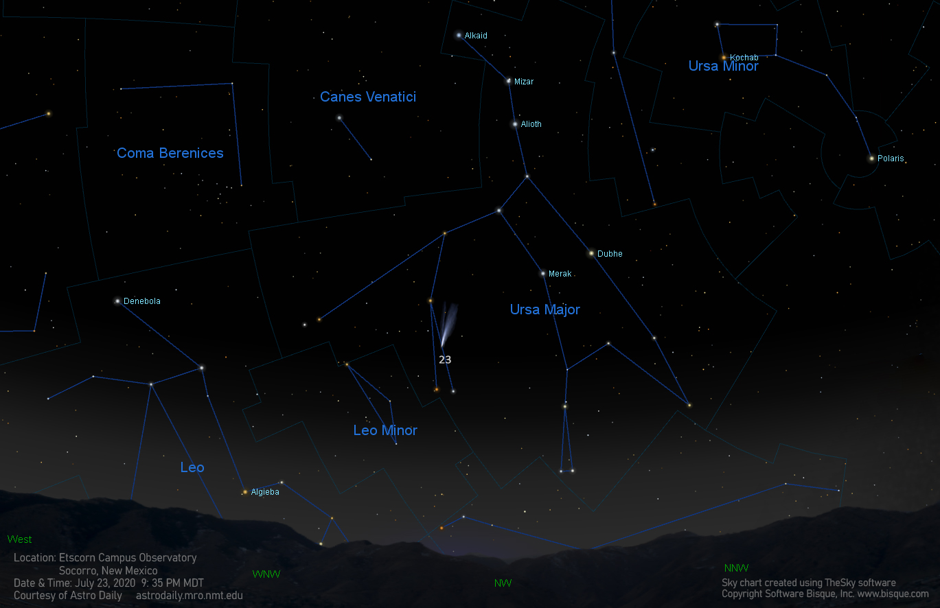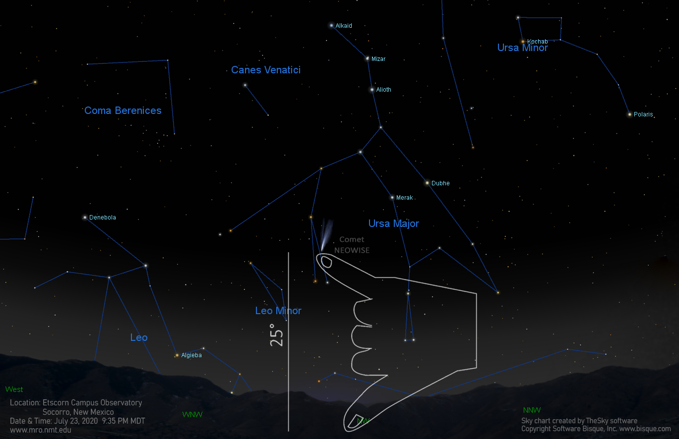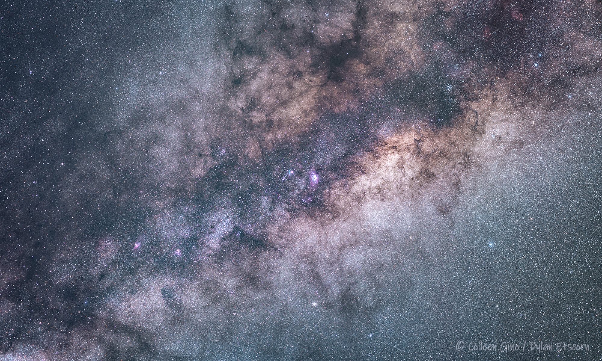
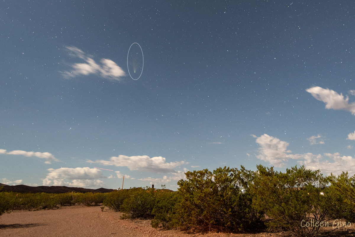
As promised, I brushed off my binoculars, charged my camera battery, and spent a couple of hours enjoying the mostly clear starry sky last night. I did find Comet NEOWISE, which continues to get dimmer not only because its tail is getting smaller as it travels farther from the Sun, but because of the brightness of the Moon. At 78% illuminated, it’s one big bright ball o’light that really lights up the night sky! When the sky is so bright, dim objects such as the comet, fade from view; the image below shows the comet in all its fading glory. If there weren’t stars in the sky one would almost think this image was taken in the daytime, with that bright blue sky and puffy white clouds. We can thank the Moon for that!
Tonight the Moon will be 87% illuminated, so will look much like the image below, which was also taken when the Moon was 87% illuminated. I’ve marked several features that will be easy to pick out with binoculars. I’ve marked the Apollo mission landing sites as well, although it might be easier to pinpoint those locations with a telescope rather than binoculars.
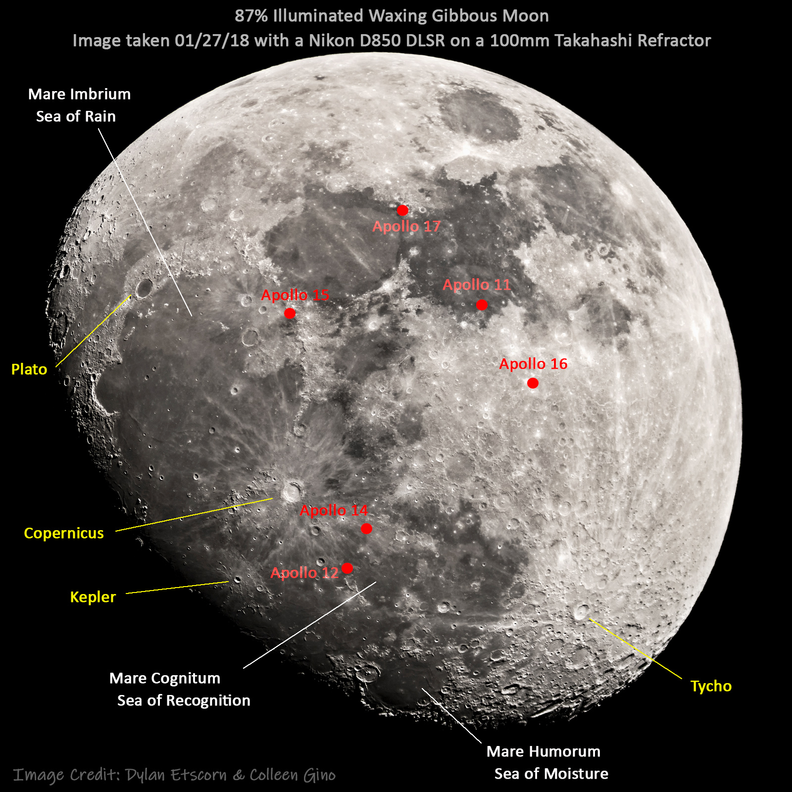
As you see in the image, the large dark areas on the surface of the Moon are named mare or seas. This is because the early lunar observers in the 17th century thought that these dark patches really were seas of water. We now know that’s not the case at all; these lowland areas of the Moon are actually volcanic lava flows and appear darker than the highland areas because of their high iron and titanium content.
The other easily distinguishable features on the Moon are craters. Almost all of these are impact craters, formed by the collision of an asteroid or comet with the surface of the Moon. The naming convention of naming craters after dead scientists was established in the 17th century. Since 1919 the job of naming craters belongs to the International Astronomical Union (IAU). It is estimated that there are more than one million craters larger than a half-mile in diameter on the surface of the Moon.
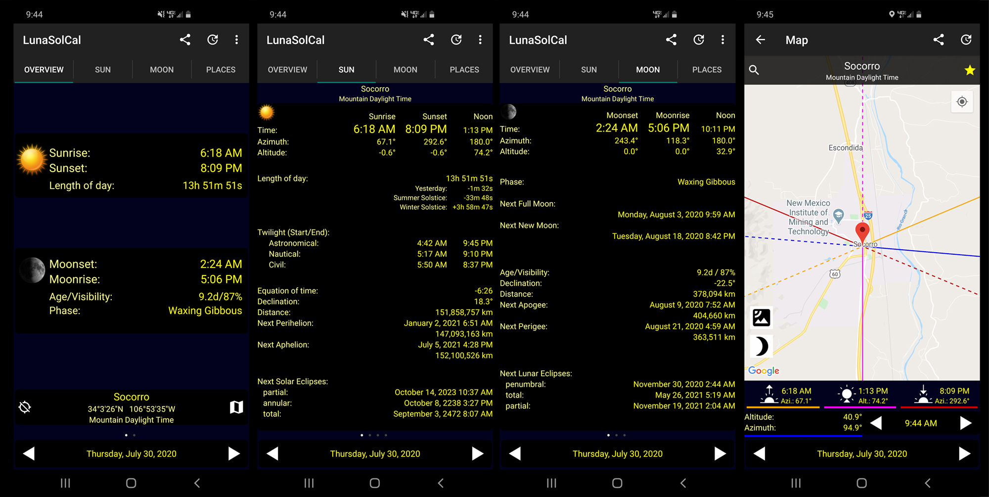
Last but certainly not least, I want to share one of my favorite apps with you, LunaSolCal. It is available for both Android and iOS devices, and there is a Windows version as well. Along with sunrise/ sunset and moonrise/moonset data, you can find out when the different types of twilight start and end, the azimuth of the rising and setting of the Sun and Moon, maximum altitude for Sun and Moon, and much more, for any location on Earth. I use this app constantly and absolutely love it! It is one of the best observational tools I’ve found. And it’s free!
That’s all for now, folks. If you have a particular topic you’d like to see me write about in the future, I’d love to hear from you! Please post your suggestions in the comment section below or email us.
M. Colleen Gino, MRO Assistant Director of Outreach and Communications