A few days ago I told you about one of my favorite apps for Sun and Moon data, LunaSolCal (found at the bottom of July 30th article). Today I’d like to share a few more of my favorite apps and websites that I find extremely useful, especially when observing the sky.
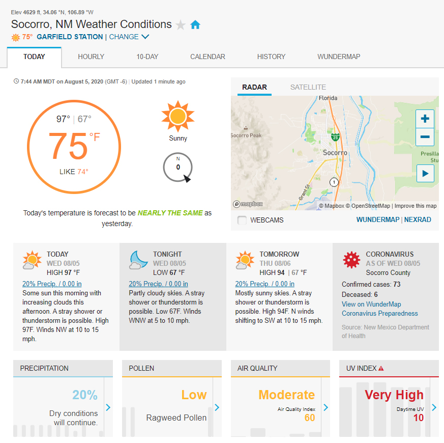
One of the first things I look at when planning an observing session is the weather. There are many excellent weather web sites and apps out there; you probably already have your own favorite. I most frequently refer to Weather Underground for general weather forecasts. You can see anything from hourly forecasts to 10 days into the future. In addition to the usual temperature, cloud cover, humidity, wind speed and direction, and precipitation data, they have pollen, air quality and UV Index data, and more. The site does have annoying ads, but for a few bucks a year you can access the site ad-free.
My other go-to weather site is NOAA’s National Weather Service. Along with the usual weather data you can find radar maps, satellite imagery, and fire weather predictions. In particular I’m a big fan of their SKYWARN Program, in which the NWS partners with local emergency managers to hold classes for the general public in which they receive storm spotting training. These storm spotters send their reports in to the NWS, supplying valuable data on severe storms. If you’re interested in participating in the SKYWARN program, check out this video on YouTube.
Another website I refer to constantly is ClearDarkSky. Aimed at amateur and professional astronomers alike, this site uses a numerical weather model to predict hourly percentage of cloud cover for over 5300 observatories and observing sites in North America. In my experience this site is very accurate.
This discussion wouldn’t be complete without a shout-out to the Magdalena Ridge Observatory’s weather web page. You can see current weather conditions at the MRO Interferometer’s central weather tower and the 2.4m telescope. You can find out information on our weather stations and view weather statistics over various periods of time, and see our Environmental Monitoring Systems’ current data (this ties in with Shelbi’s blog post this past Monday). If you’re tired of looking at charts and graphs, take a look at our live webcams!
Since I’m a lightning and storm photographer as well as an astrophotographer, I use a couple of different apps to track storms, NOAA Weather Radar (free) and RadarScope ($9.99). Both of these apps display high resolution radar data as well as severe thunderstorm and flash flood warnings. My favorite web site for viewing lightning activity is Real Time Lighting Maps, where you can see the location of lightning strikes in real time for locations worldwide. One of my favorite features of this site is the thunder predictor — when a lightning strike occurs a little red dot appears on the map, then immediately a circle appears around and concentric with the dot and starts growing larger and larger until it fades away. This growing circle shows the thunder sound front, so you can see on the map when you’re going to hear the thunder at your location. How cool is that!
That’s it for my favorite situational awareness apps, as I call them. Next up are the sky mapping apps and websites. I have so many of those I use that the subject deserves its own blog post, so stay tuned for that in the near future! Meanwhile, I’d love to hear about your favorite apps and websites, please share in the comments below!
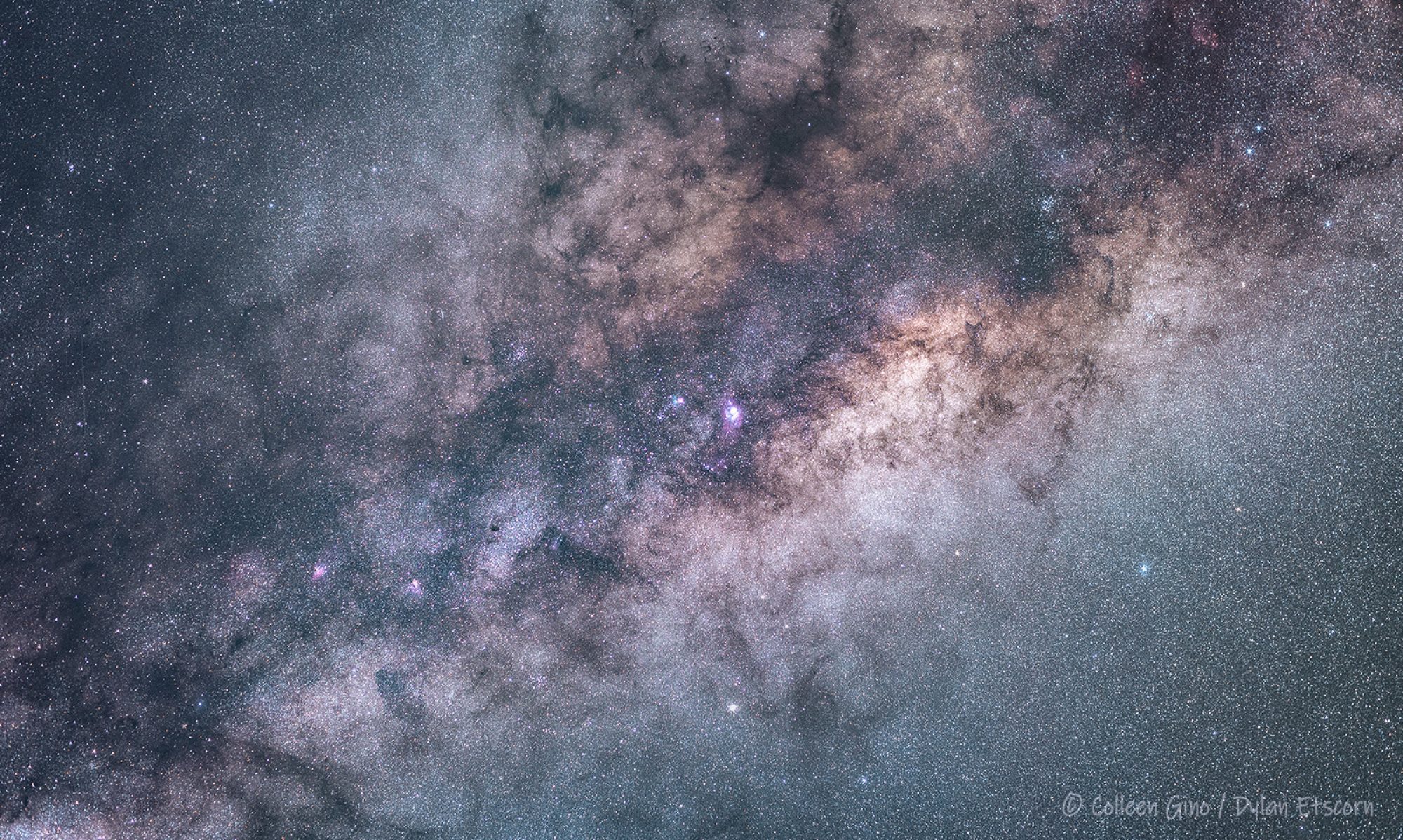
M. Colleen Gino, MRO Assistant Director of Outreach and Communications
For users of the Linux OS, I use an app called Conkywx that allows you to customize the location of the nearest PWS (Personal Weather Station) to your location via weather underground. It also contains other valuable resources via the built in system monitor Conky resident in Linux OS. Conkywx website link below.
Thanks for the info, Tom!
Love to see this every day !